
The highly-anticipated Bataan-Cavite Interlink Bridge is close to becoming real.
It is said that the Department of Public Works and Highways (DPWH) is now hard at work completing the detailed engineering and design of the Bataan-Cavite Interlink Bridge project.

Currently, the department is conducting geophysical surveys and geotechnical investigations over Manila Bay to evaluate the underground conditions — a process that is now 55% complete.
The said inter-island bridge will be 32 kilometers long and will connect Central Luzon and the Southern Tagalog Region.
Related
- CCLEX Toll Fees and FAQs: Everything you need to know about the longest bridge in PH
- Speed limits on different PH roads
- How to replace Easytrip RFID sticker and card
Meanwhile, the feasibility studies have already been completed during the previous administration.
The bridge will have four lanes and, when completed, will significantly cut the travel time between Cavite and Bataan to 20-30 minutes from 5 hours.

SEE ALSO: How to get driver’s license in the Philippines
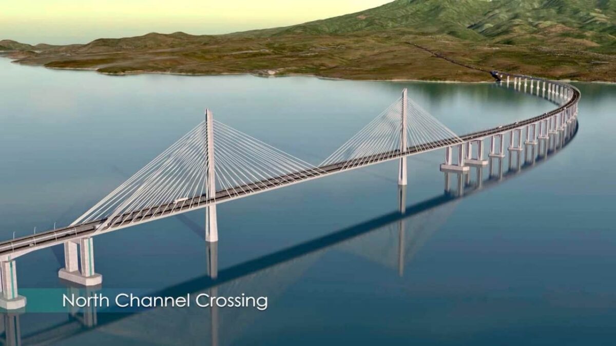
It will also have two cable-stayed navigation bridges for Corregidor Island. The project, which will have North Channel and South Channel bridges, will span 400 meters and 900 meters, respectively.
In Cavite, the bridge will align in the area of Barangay Timalan Balsahan, Naic, while in Bataan, it will be around Barangas Alas-Asin and Barangay Mountain View in Mariveles.
Napakaganda ng plano ng gobyerno, mapakinabangan ng maraming tao. Sana hindi lang sa malapit sa NCR ang ganyang plano, sana magkaroon din sa mga probinsya katulad ng Sorsogon to Masbate kailangan may bridge para hindi na mahirapan ang byahe from NCR to Masbate, wala ng lipat lipat sa barko.